Flood Risk
Assessments by Castledine & Co
Flood Risk Assessments (FRA)
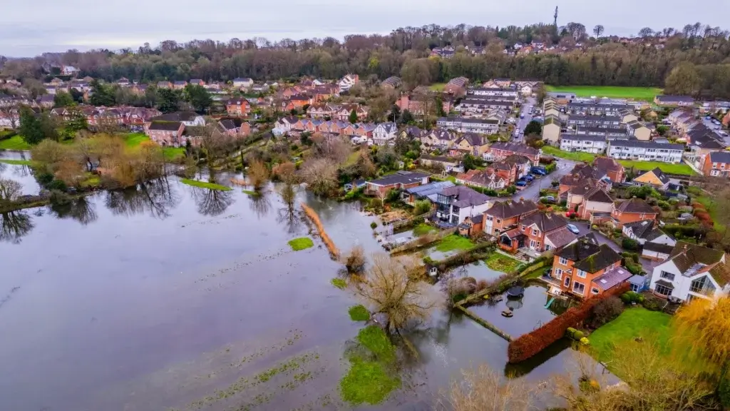
A Flood Risk Assessment (FRA) is a key part of the planning process for developments in areas affected by flood risk, surface water flooding, river flooding, or other sources of flooding. An FRA can help support planning applications, identify site constraints, and show how flood risk will be safely managed.
Whether you are building a new home, creating a house extension, converting a property, or developing a small residential site, a professional flood risk assessment may be required by the local planning authority. This is especially important where development is proposed in Flood Zone 2, Flood Zone 3, or in areas with known surface water flood risk.
A well-prepared FRA can help with supporting a planning application, Identifying potential flooding risks, demonstrating safe site drainage, protecting property and future occupants, meeting local authority and Environment Agency requirements.
A typical Flood Risk Assessment considers Flood zones, surface water flood maps, site levels and topography, ground conditions, existing and proposed drainage arrangements, safe access, egress, and finished floor levels.
An FRA provides a clear and practical way to assess risk, improve site design, and support compliance. When prepared properly, it helps deliver safe, sustainable development while reducing the impact of flooding on people, property, and infrastructure.
Flood Risk Assessment
The reason for a Flood Risk assessment (FRA) requirement for any planning application is to clearly show that you have evaluated the sources of flooding risks affecting your proposed development. Having a Flood Risk Report present within your planning application indicates you have shown a duty of care towards any residents of the property, but also for the building itself and for the surrounding wildlife habitat. These reports show that the assessment has identified all forms of flooding, from heavy surface water runoff to rivers/streams and even coastal waters. The Lead Local Flood Authority (LLFA) will have its say in your planning, so this report will give you a better chance for your planning to be passed. These reports will also give you a better chance of obtaining a mortgage and even property insurance.